
Trace an Edmond Street Directory
The useful order is address first, then parcel, then recorded land history. Edmond lies in Oklahoma County, while city tools and county offices maintain different parts of that trail. The City locator tests the municipal boundary and supplies street, ZIP, plat, block, lot, ward, and service context. The Assessor then links a physical location to an account and owner fields. The County Clerk's Registrar of Deeds index supplies the recorded transaction trail. Taken together, those records are stronger than a single address match.
- Enter the address in the Edmond address locator. Use the house number, direction, street name, and suffix without punctuation; add an apartment or suite after a space and # when needed.
- Search the Oklahoma County Assessor Public Access System by physical address. Keep the real account number and parcel PIN with the situs result.
- Open the address and parcel layers in the Edmond GIS map service to compare the parcel, lot, block, plat, roads, City Limits, and Outside Edmond City Limits layers.
- Use OKCC.ONLINE, choose ROD and then Address. If that search misses, try the owner name, legal description, or PID and check both grantor and grantee roles.
- For a past household clue, consult the Edmond History Museum's directory and newspaper holdings. The historical shelf is described in more depth in the Edmond city directory.
The sequence keeps roles distinct. A parcel is a mapped piece of land, a deed is a recorded instrument, and a directory entry is a dated household clue. None alone proves that every person at an address is current.
Test Each Edmond Street Address
Before using a street directory result, run the location through the city locator. It can return either a valid address within Edmond or a result not located within the city, along with ZIP, plat, block, lot, section and township-range, ward, and service fields. That makes it the right first check for a postal address that says Edmond but may lie in county territory. The GIS service deliberately offers both City Limits and Outside Edmond City Limits layers for the same reason.
Address text also changes across records. USPS uses a delivery address and ZIP. The Assessor distinguishes the physical situs from an owner mailing address. A deed relies on its legal description, and a plat identifies a subdivision layout. Record each version before deciding two hits refer to the same place. The city's official street index adds direction, addition name, and map code, which can separate similarly named streets or an old addition reference.
Note: A postal Edmond address can be outside the incorporated city, so use the locator rather than ZIP alone for an Edmond boundary decision.
Edmond Street Directory Property Fields
The Assessor search is the main current-property entry point for an Edmond street directory search. It accepts Name, Physical Address, Real Acct #, and Personal Acct #. For an owner name, use last name first and a % wildcard for a partial match. A physical-address search requires the direction unless the wildcard option is used. Real accounts begin with R and have nine digits; personal accounts begin with P and have seven. Sales and deed transaction criteria also include tax year, deed type, account type, building description, vacant or improved land, and city.
| Assessor field | How it works | Street-search value |
|---|---|---|
| Name | Last name first; partial % match | Find an owner when the address form fails |
| Physical Address | Direction required unless wildcard option is used | Find the situs record for a known street number |
| Real Acct # | R plus nine digits | Return to the same real-property account |
| Personal Acct # | P plus seven digits | Separate a personal-property account from real property |
| Sales/deed criteria | Tax year, deed type, account type, building description, land, city | Narrow a property-history question |
The result detail can show the owner, parcel PIN, physical location, assessment values, exemptions, millage, estimated tax, sales, and property detail. It is an assessment record, not a certified title record. The Assessor offers free public searching and also handles in-person, copy, and data requests; custom reports and ownership-radius reports carry fees.
The official Assessor search form shows the four address and account paths used here.
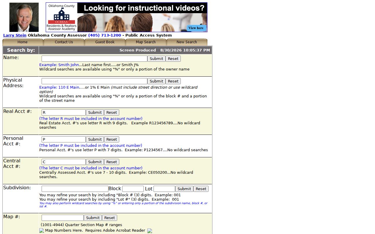
Those separate boxes matter because the owner name, physical situs, and account identifier may lead to different but related Edmond records.
Map Edmond Streets and Parcels
Edmond GIS supplies the map context that an assessment row cannot. The address layer includes house number, direction, street name and type, building number, lot, block, plat, complex, address type, ZIP, and update data. Parcel polygons carry parcel number or PARCELID, lot, block, plat name, geometry, and update information. Map and identify tools expose parcels, roads, schools, parks, zoning, flood layers, and municipal-boundary layers. Use the map to see where a street record belongs, then use the county records for ownership.
A 1998 City of Edmond and County Assessor data-sharing agreement produced the parcel layer. The city says the address match rose from 65% to 95%, and parcel geometry is generally updated every two to three months through aerials, plats, surveys, lot splits, and warranty deeds. The stated accuracy is three to ten feet. That history makes the map valuable for context, yet a legal document still controls a title question.
The public GIS map service displays the Edmond layers used to compare an address, parcel, city limit, and street.
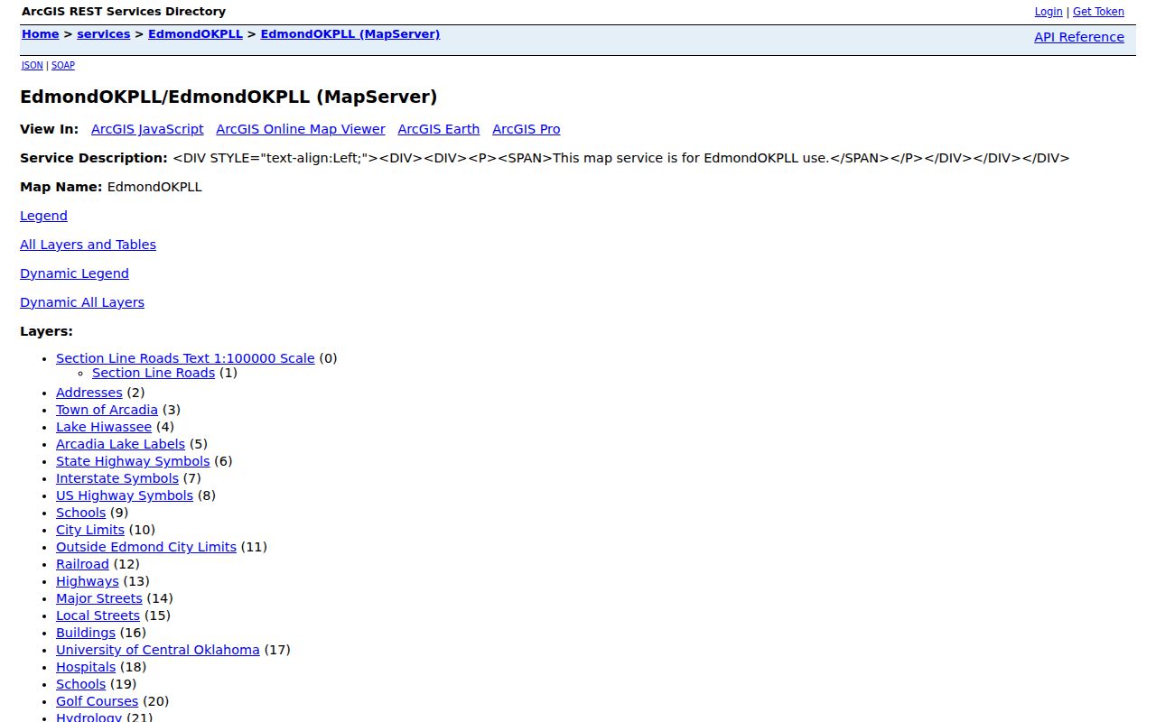
The map is especially useful when a street crosses an addition or a city-limit edge, but it should not be read as a live household roster.
Follow Edmond Street Deed Records
For a recorded ownership chain, use the County Clerk's ROD index after the parcel search. OKCC.ONLINE offers Name, Address, Document Type, Book and Page, Instrument # or PID, and Advanced modes. Name searches can be limited to grantor or grantee and use Starts With, Exact Match, or Contains. The result row supplies an instrument number, grantor, grantee, recording date, and document type. A grantor is the party transferring an interest; a grantee is the party receiving it.
- Parcel
- A mapped piece of land tied to an account or identifier, not a complete record of everyone who uses it.
- Situs address
- The property's physical location, which can differ from the owner's mailing address.
- Plat
- A recorded subdivision map that can identify lots, blocks, additions, streets, and easements.
- Criss-cross directory
- A historical directory arranged by address or street, useful for dated household clues rather than current proof.
Open or request each relevant instrument and record its number, date, parties, document type, legal description, and prior reference. Then search the earlier grantee as a grantor. The chain is name-indexed, not a single history button. When a modern address fails, use the lot, block, addition, legal description, or PID. Unofficial public land images can be redacted and free, while official unredacted electronic images are charged. Some sensitive document types are not available online.
The OKCC.ONLINE ROD portal is the online route to those address and instrument modes.
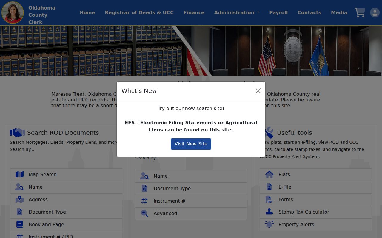
When the index or image does not answer the question, the County Clerk at 320 Robert S. Kerr Ave. in Oklahoma City offers inspection and copies, including older books or images.
Edmond Street Name Changes
Old Edmond street references need a local translation. The Southern Kansas Railway survey marked Mile Marker 103 in 1886, and the station received the name Edmond in 1887. The survey's township line became present 15th Street, while a section boundary became 2nd Street. First and Second and Broadway were the early graded streets near the railroad. Broad Street became Broadway by 1890. A historic deed, newspaper notice, or street directory may therefore use a name that does not match a modern search exactly.
Original Townsite and named additions complicate the match further. The city Street Names List pairs street direction and name with an addition name and map code. For an older location, keep the addition, lot, and block with the street text. If the house number is absent, a plat and the historical street wording can be more useful than repeating a modern address search.
Note: The verified Edmond story is a street-name and grid change, not a missing-records disaster; no official source located a courthouse fire that destroyed the local chain.
Edmond Street Records at City Hall
City records add a building and planning timeline to an Edmond street directory search. The Edmond Archive Center can search keywords, an archive selector, time period, and a date range. Observed categories include City Council and Planning Commission minutes from 2000 through 2012, building permits issued, building activity reports, budgets, action reports, and water-resource reports. A name or address in a planning action, permit, or minute can help date a project, but it does not establish a resident roster.
The current Edmond permit portal requires sign-in on its default screen. The city says an account can support applications, status, current permits, and fee payment, but the verified public search labels were not exposed. For a missing record, use the city's JustFOIA route or send a mail or in-person request through the City Clerk or the appropriate department. Building and Safety, Code Enforcement, Engineering, Planning and Zoning, and Public Works requests are routed as other city records; mixed requests may need more than one form.
The city's zoning address finder accepts an address or map click and displays air-photo, overlay-district, and specific-use-permit layers. It is current map context, not evidence of who lives at the property.
Check Edmond Street Tax Accounts
The Treasurer is a useful cross-check once the assessor account is known. Its Public Access tool searches by account number or name and address. Name searching uses last name then first name, ignores case and whitespace, omits punctuation, and permits partial names. The account view covers the current year and six prior tax years whether paid or unpaid, all unpaid accounts regardless of year, and tax-sale liens not redeemed. Tax status can reveal an account trail, but it does not prove title or occupancy.
The Oklahoma County Treasurer Public Access search presents the account and name/address routes.
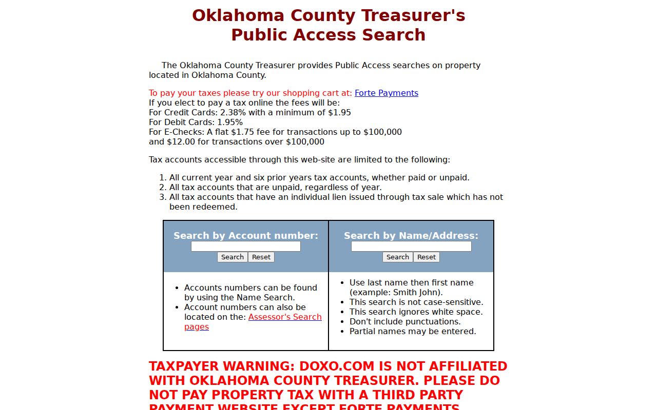
For payment or cashier questions, the Treasurer lists (405) 713-1311. Card, debit, and eCheck payment fees apply, but those payment charges are separate from a search result.
Edmond Address Record Coverage
These records are keyed to an address in different ways. The coverage table helps keep an owner record, a map feature, a tax account, and a dated directory entry from being treated as the same kind of proof.
| Address record | Custodian | What it can show | Access route |
|---|---|---|---|
| Assessment roll | Oklahoma County Assessor | Owner, mailing address, situs, account, values, sales | Free portal, requests, or in-person help |
| Address and parcel map | City of Edmond GIS | Parcel, lot, block, plat, ZIP, boundary, street context | Public map and locator |
| Deeds, liens, plats | Oklahoma County Clerk | Grantor, grantee, instrument, date, legal chain | ROD portal, counter, copies, open-records request |
| Tax account | Oklahoma County Treasurer | Current and prior tax status, unpaid or tax-sale data | Public search or county cashier |
| Permits and planning | City of Edmond | Project, alteration, zoning, applicant, planning evidence | Permit portal, Archive Center, JustFOIA, mail, or counter |
| Voter records | State Election Board | Qualified voter-list fields or personal registration verification | Portal for self-service; qualified EDW request by email, fax, or mail |
Voter data is not a street-by-street public phone or email list. The OK Voter Portal requires the name as registered and date of birth for personal verification. Qualified Oklahoma residents, citizens, candidates, and recognized-party representatives may request the State Election Board's full electronic list under 26 O.S. §7-103.2; custom requests can use residence ZIP and data updates nightly. Restricted Records and Address Confidentiality Program protections can remove or suppress address information.
Edmond Street Record Limits
An address record answers only its own question. The Assessor identifies an assessed owner and may show a mailing address. The GIS layers locate parcels and city services. A deed records a land transaction. A permit records an application or project. A historical directory is a dated snapshot. None is a full, current list of every person at a street address. Utility customer data and motor-vehicle address data are not general public street-directory sources, and protected voter records may be absent by design.
Lawful use. Edmond street and property records are for personal, lawful research. Do not use address information to stalk, harass, intimidate, or harm anyone; Oklahoma's stalking law, 21 O.S. §1173, addresses repeated conduct that causes fear or harassment.
When the public web stops, use the documented fallback. Ask the County Clerk for index help, paper files, or copies; make a specific Oklahoma Open Records Act request to the right city or county custodian; and consult the Edmond History Museum or Oklahoma Historical Society for directories, newspapers, Sanborn maps, church books, and 1889 land material. The Museum's local-history holdings are a better next step than assuming an incomplete online index is a negative result.
The Edmond address locator screen shows the city, ZIP, plat, lot, ward, and service return fields that begin the address chain.
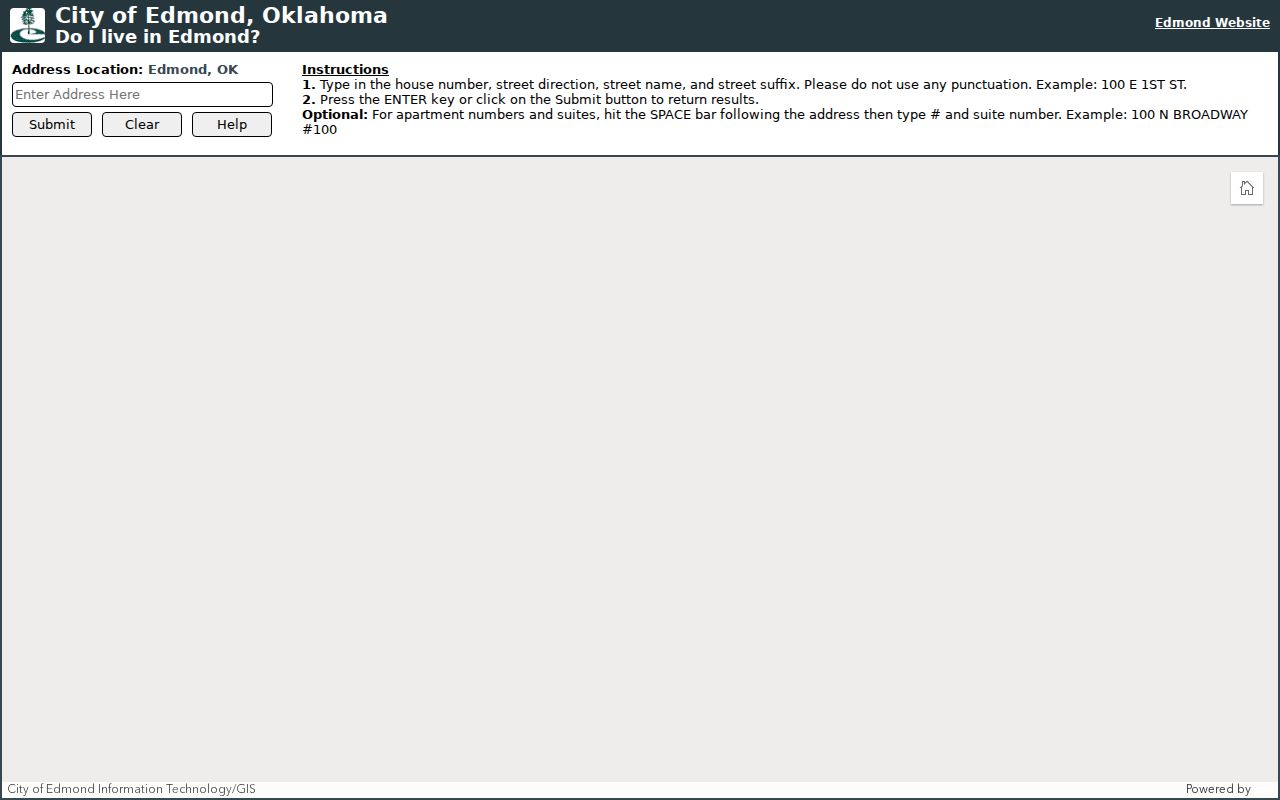
Its city-limit result is a geographic check, while the county records and historical collections supply the separate ownership and time layers.